In 2020 I started a still ongoing challenge, and it might take a few more years before I finish. I’m planning to walk around all lakes in Switzerland that are more than 2 km2. I will only circle lakes that are totally in Switzerland, leaving out Lake Geneva and Lake Constance, since that would be a challenge in itself. There are a couple in the Alps where this won’t be possible because there is only a path going in and out, but I figure that counts too. It will take 5 to 6 days to walk around the largest ones and for the smallest I will only need a couple of hours. There are 32 lakes on my list. Quite a few names I have never heard before, especially in the French part of Switzerland. I look forward to discovering new regions in Switzerland.
Klöntalersee
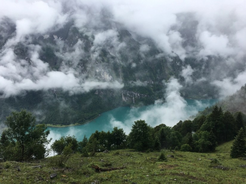
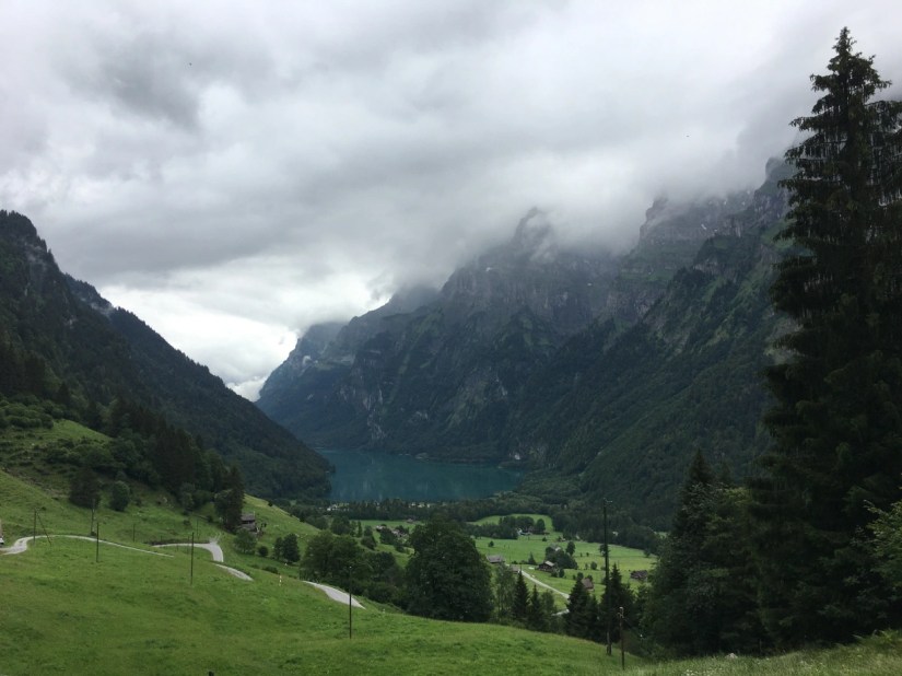
Several people have told me about the Klöntalersee and mentioned how beautiful it is, but I never been there. I knew that the day I had chosen would be quite cloudy, but then again this would also mean fewer people. In the end I didn’t see another person on the first half of the hike.
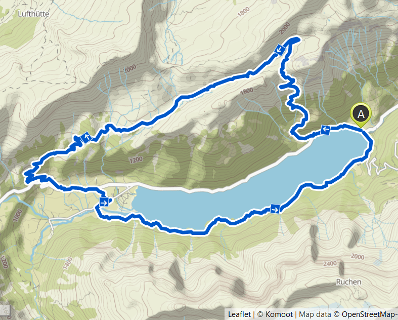
As you can see on the map below, the climb up from about 900m to 1700m is very steep. I took it slowly and with the beautiful views over the lake it was no problem at all. It did rain a bit as I walked higher. Since it had rained a lot the previous day, the path was very wet. Sometimes the water just flowed over the path and on the cow pasture it was very muddy.
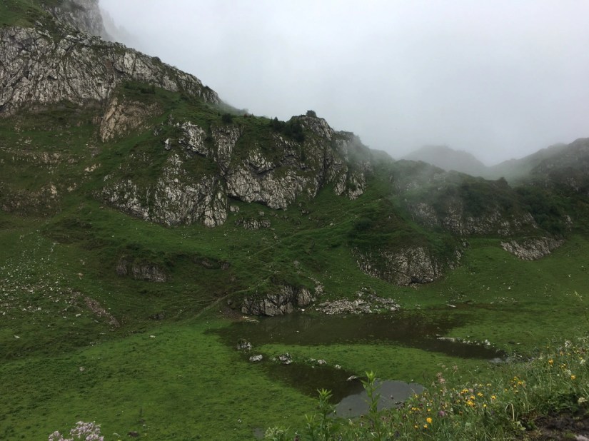
At the top there is a small but beautiful valley with a moor. After that the path went down back to the lake, the last part was again a bit steeper. Because of the rain, the stream that flows into the lake came over the banks. The way back followed the lake and I saw the amazing waterfalls close up. It really is a beautiful lake and I’m planning to come back soon in sunnier weather.

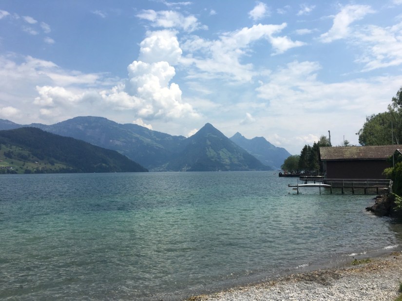
Vierwaldstättersee – Part 1
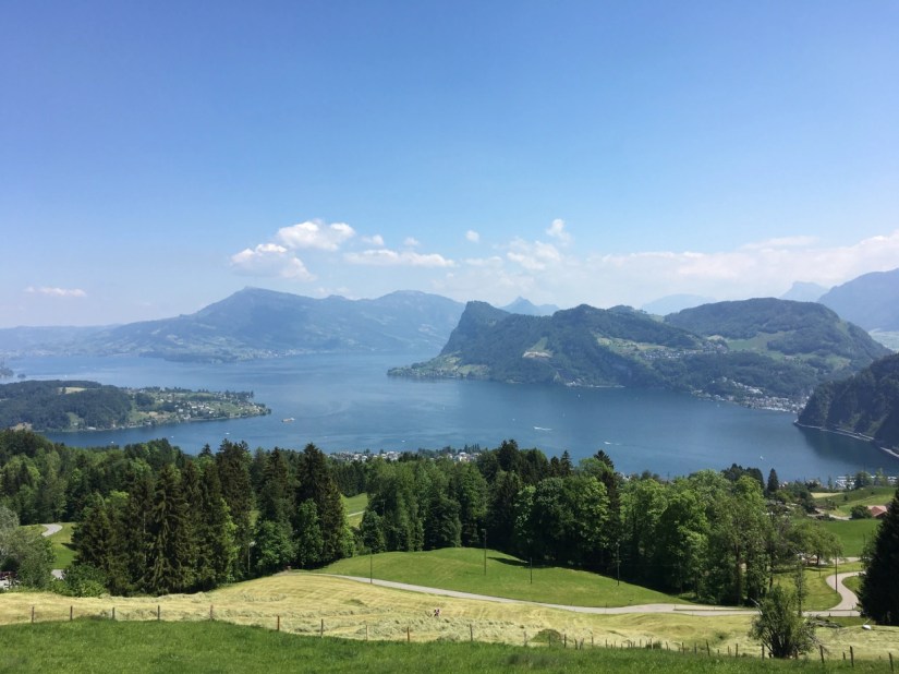
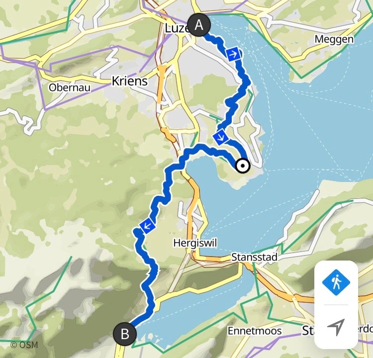
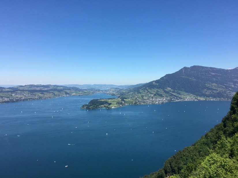
After two months in lockdown, I was ready for another lake. The Vierwaldstättersee or Lake Lucerne is the second largest lake in Switzerland. Because of its unique form with six arms, it takes quite a while to walk around. So today I tackled the first part from Lucerne to Alpnachstad.
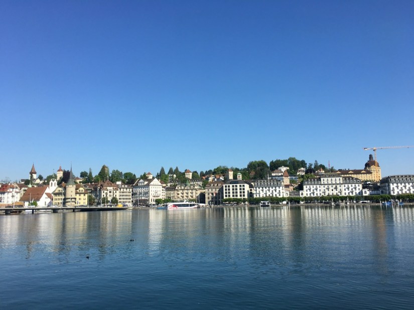
The lakes surface is 114 km2 and the shore is about 160 kilometres long. There are 24 towns or villages that share the lake shore, the best known and largest of which is Lucerne.
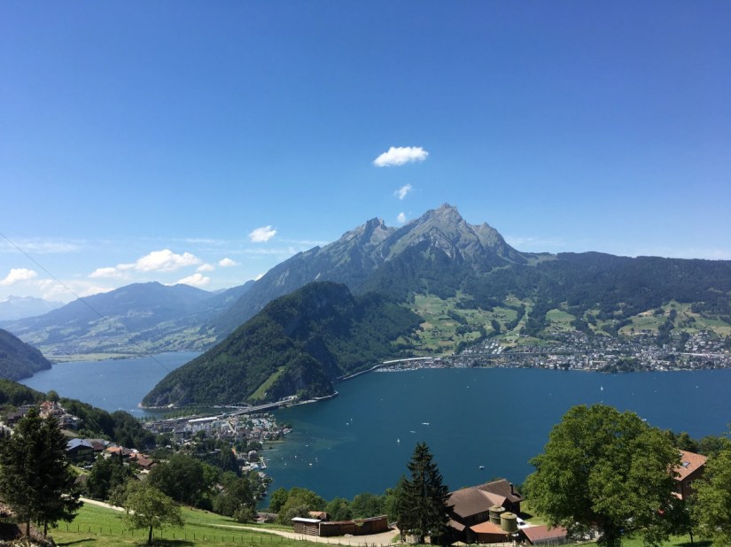
It starts with a pretty walk along the lake before the path turns inland over the Horwer peninsula. On the way there you get some beautiful views towards Mount Pilatus, which is my favourite mountain.

In Horw, a suburb of Lucerne you come back to the lake, before climbing the next hill towards the Renggpass. This used to be the only overland link to the Canton of Obwalden until the late 19th century. The views over the lake were stunning. After the pass, a steep path went back down to the lake. The last part followed again the lake shore.

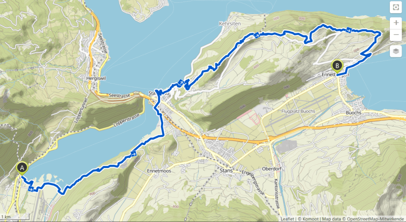
Vierwaldstättersee – Part 2
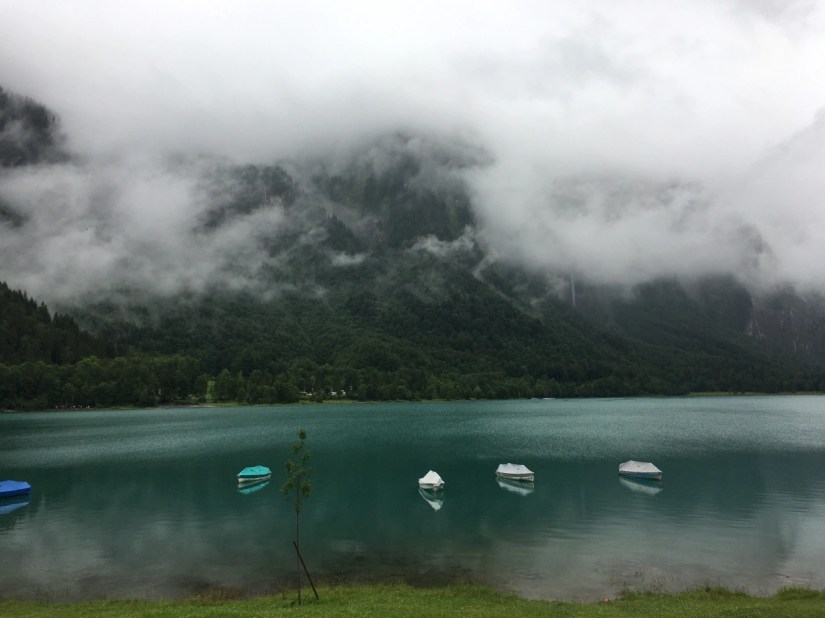
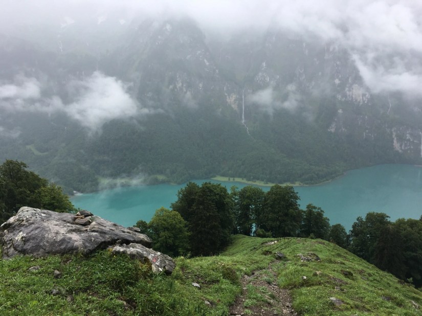
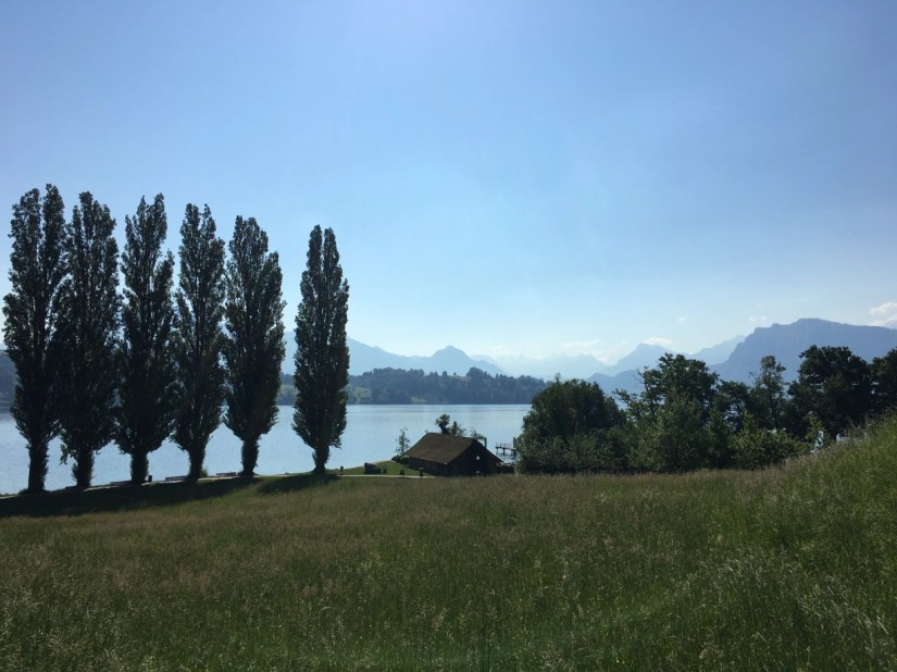
The second section from Alpnachstad to Ennetbürgen included over 900 m in elevation. Since the section starts and ends at the lake shore, everything you walk up you also have to walk down again. Again, I had some amazing views over the lake, which was full of boats. One of the highlights was the view from Bürgenstock. Just before you reach the highest point, the path also makes a turn, which opens the view to both sides of the Bürgenstock. On one side you see over the lake and the midland, on the other towards the mountains.
Bürgenstock is a fancy vacation resort with many newly built hotels. There were lots of people walking around that came up by car. This always creates these weird moments where the tourists mix with the hikers, and you feel like you must be an alien before the tourists disappear again.
A short way after Bürgenstock there is another viewpoint over the lake before the path goes back down towards the lake. Then I passed the pilgrimage site of St Jost before I ended this section in Ennetbürgen.
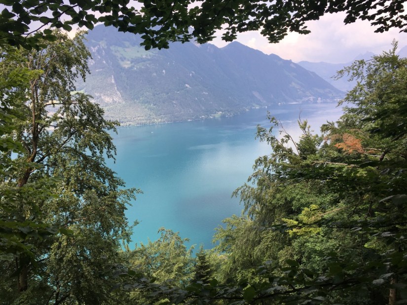
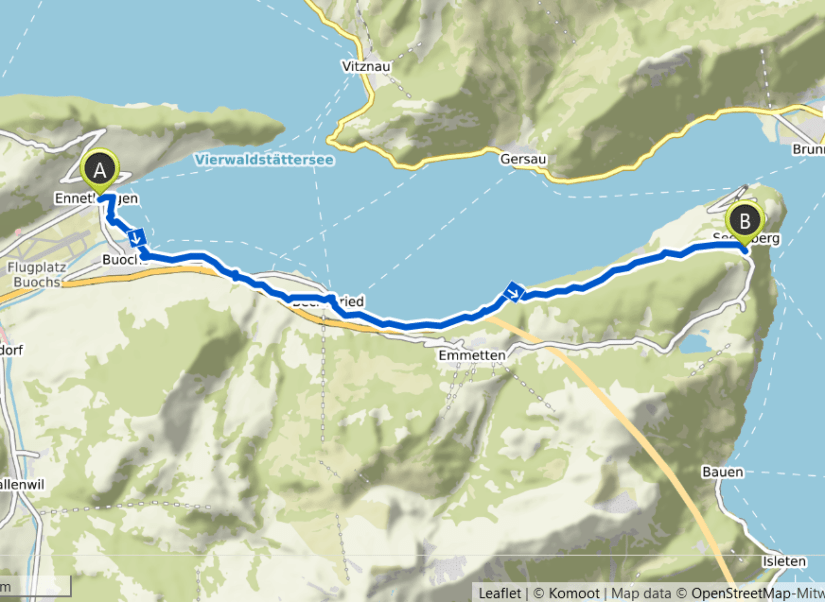
Vierwaldstättersee – Part 3
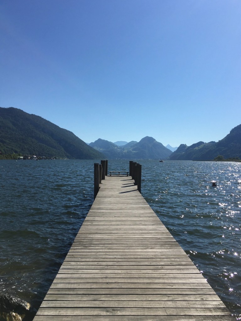
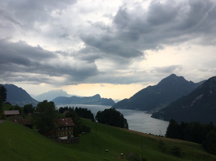
This was a pretty short section from Ennetbürgen to Seelisberg. I was planning to walk as far as Flüelen. But I could see a thunderstrom looming. It started to rain shortly before I reached Seelisberg. I was really lucky the weather did hold that long. I got really wet and the next 16 km are a section that can’t be split. So, I decided to stop in Seelisberg and come back soon.
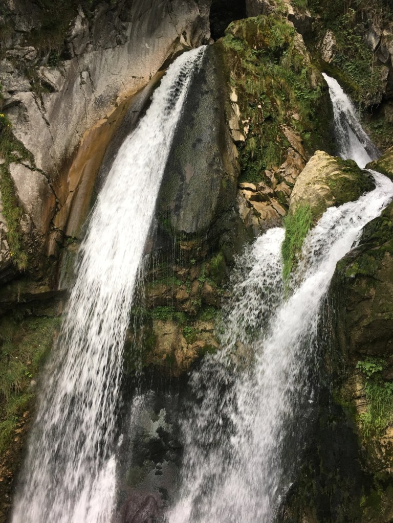
The first part was flat mostly following the lake. Then some steep stairs go up alongside the Risletenschlucht with a very impressive waterfall.
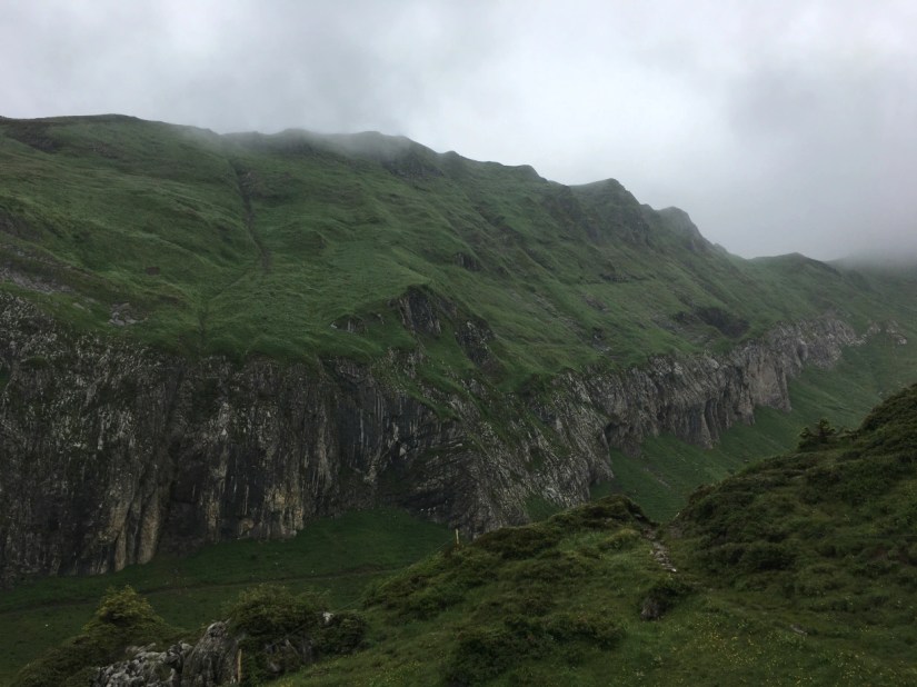
After the steep part was over, the path continued relatively easy towards Seelisberg. The view back looked very stormy.
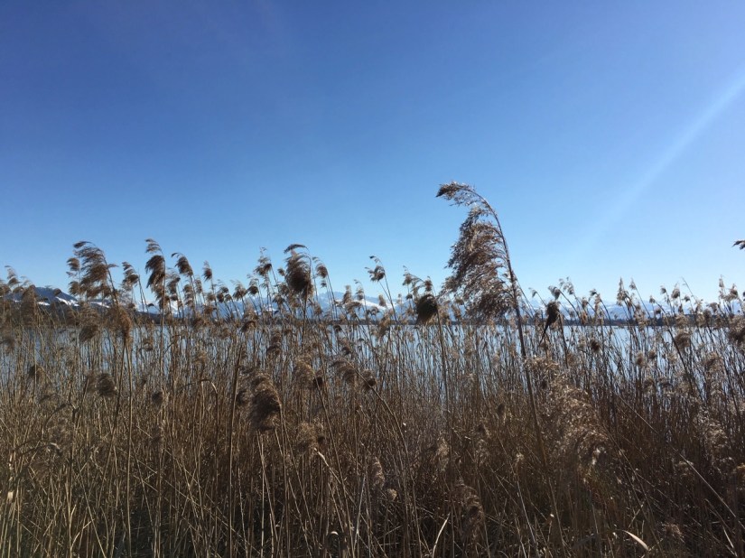
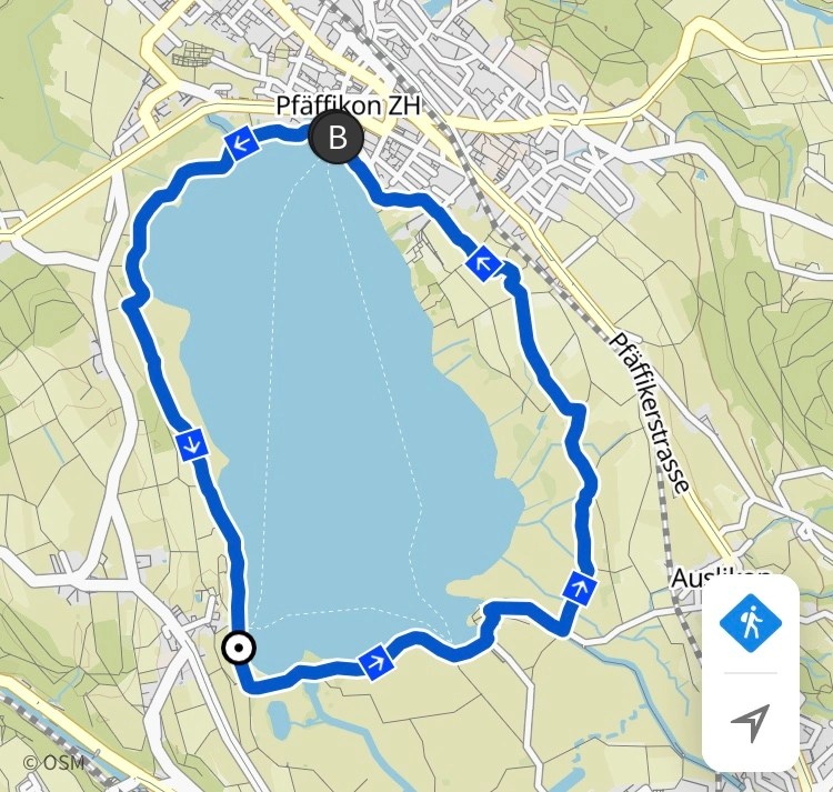
Pfäffikersee
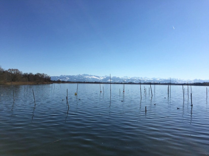
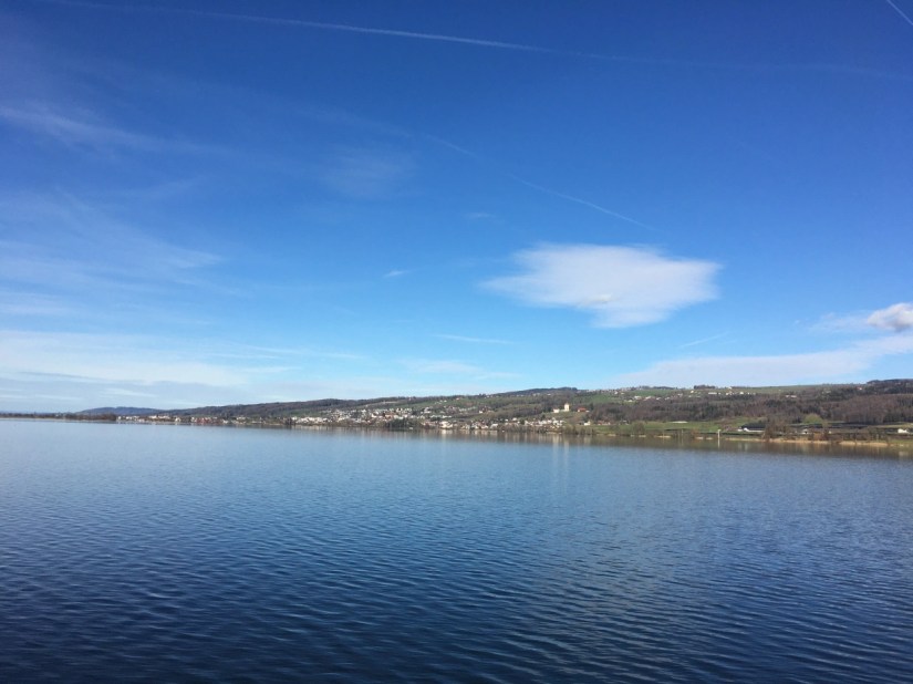
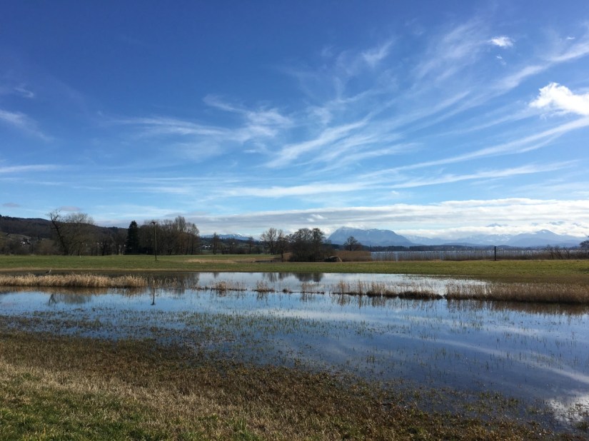
The Pfäffikersee is a small lake in the Canton Zurich. It is 3,3 km2 and the walk around the lake was about 8,85 km. The whole path is wheelchair acessable and basically flat. I have never been to the Pfäffikersee before. It is a small lake, but also very beautiful with the view towards the Eastern Swiss Alps. Moorland surrounds the lake, so it is a good breeding ground for many birds. There is also a lot of reeds around the lake. On one side there are the remains of an old Roman fort.
Baldeggersee
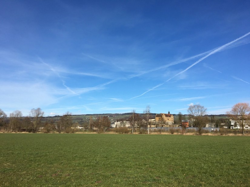
I decided to start with the Baldeggersee, since it’s a relatively short walk with 14.7 km. I walked quite fast, and it took me less than three hours. It is the 18th largest lake on the list with 5,2 km2, it’s 2, 4,5 km long and 1,7 in width.
I went to high school in Baldegg, one of the villages next to the lake and we used the spend a lot of time at the lake, swimming in the summer or just taking walks in the evening. We even had a spot at the shore where we spent long hours talking. But I never managed to walk around it. So even though I know this aera very well, I discovered some new things.
The lake was formed during the last ice age. It belongs to Pro Natura, one of the most important Swiss Environmental Charities. On my walk I saw lots of storks, one pair was already nesting. There were also many other birds.
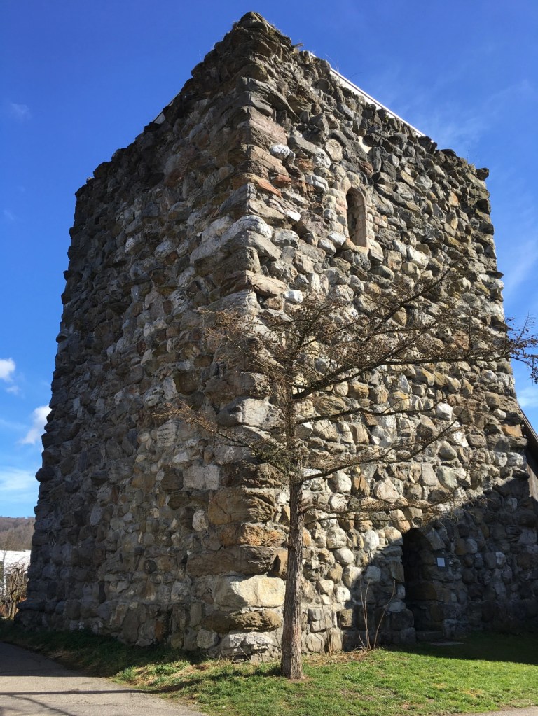
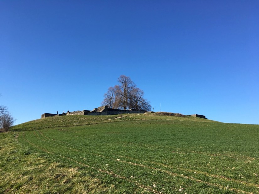
There are a few prominent buildings around the lake. One is the monastery of the Franciscan nuns in Baldegg where I went to school. Another one is the Heidegg Castle built by the Habsburgs in the 13th century, today it is often used for weddings. And there is the Megalith Tower, which was built in 1237. Its walls are up to 3,5 meters thick. I saw it for the first time on my walk.